Mountain Home AFB · Idaho · Snake River corridor
Mountain Home Air Force Base
The densest raptor nesting concentration in North America.
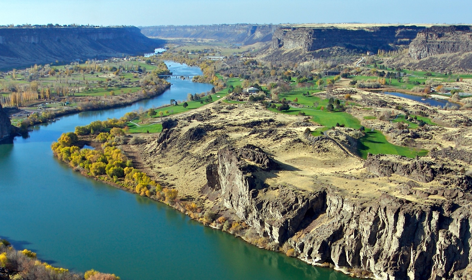
Snake River Canyon, Idaho · chadh (CC BY 2.0)
Corridor narrative
Why protect this corridor.
Mountain Home Air Force Base sits on the high desert of the Snake River Plain, where the river runs through one of the most spectacular raptor landscapes in the world. The Morley Nelson Snake River Birds of Prey National Conservation Area — managed by BLM, established 1993 — extends along 81 miles of canyon downstream of the base and supports the densest nesting concentration of raptors in North America.
While Lewis & Clark didn't travel this particular reach of the Snake (the Corps' 1805 route crossed Lemhi Pass into Idaho via the Salmon, and the 1806 return passed north of here through the Clearwater drainage), the watershed itself is the Lewis & Clark river system, and the recreation density here is national-scale. C.J. Strike Reservoir, Bruneau Dunes State Park, the Bruneau-Jarbidge Wild & Scenic River, and the BLM Owyhee Front OHV system together form one of the densest mixed-use recreation clusters in the inland West.
Mountain Home is the Snake River Plain anchor: the base, the Birds of Prey NCA, and the Snake River canyon are functionally one landscape, and easements with willing agricultural landowners on the high-desert bench between the installation and the canyon keep that buffer open and compatible with the installation's mission — the incompatible development REPI exists to head off. Documenting the NCA reach and C.J. Strike Reservoir with continuous 360° imagery provides the evidence base for REPI reporting and supports BLM's NCA management record.
Lewis & Clark connection
Snake River Plain corridor — adjacent to BLM's Morley Nelson Snake River Birds of Prey NCA. The Corps' return route in 1806 crossed the Snake drainage to the north; this segment of the Snake was not directly travelled, but the watershed is the same and the recreation density is national-scale.
Watershed-connected to the LCNHT but not directly on the 1805-06 expedition route. The Corps' westbound 1805 path crossed Lemhi Pass via the Salmon River; the 1806 return crossed the Clearwater drainage to the north. The Snake at Mountain Home is in the same river system but ~150 miles upstream of any reach the expedition traveled. The framing here is corridor-by-watershed, not corridor-by-step.
Only major active-duty AF base in the Snake River corridor. The Birds of Prey NCA adjacency offers a textbook REPI buffer narrative — one of the densest raptor nesting concentrations in North America.
See the ground
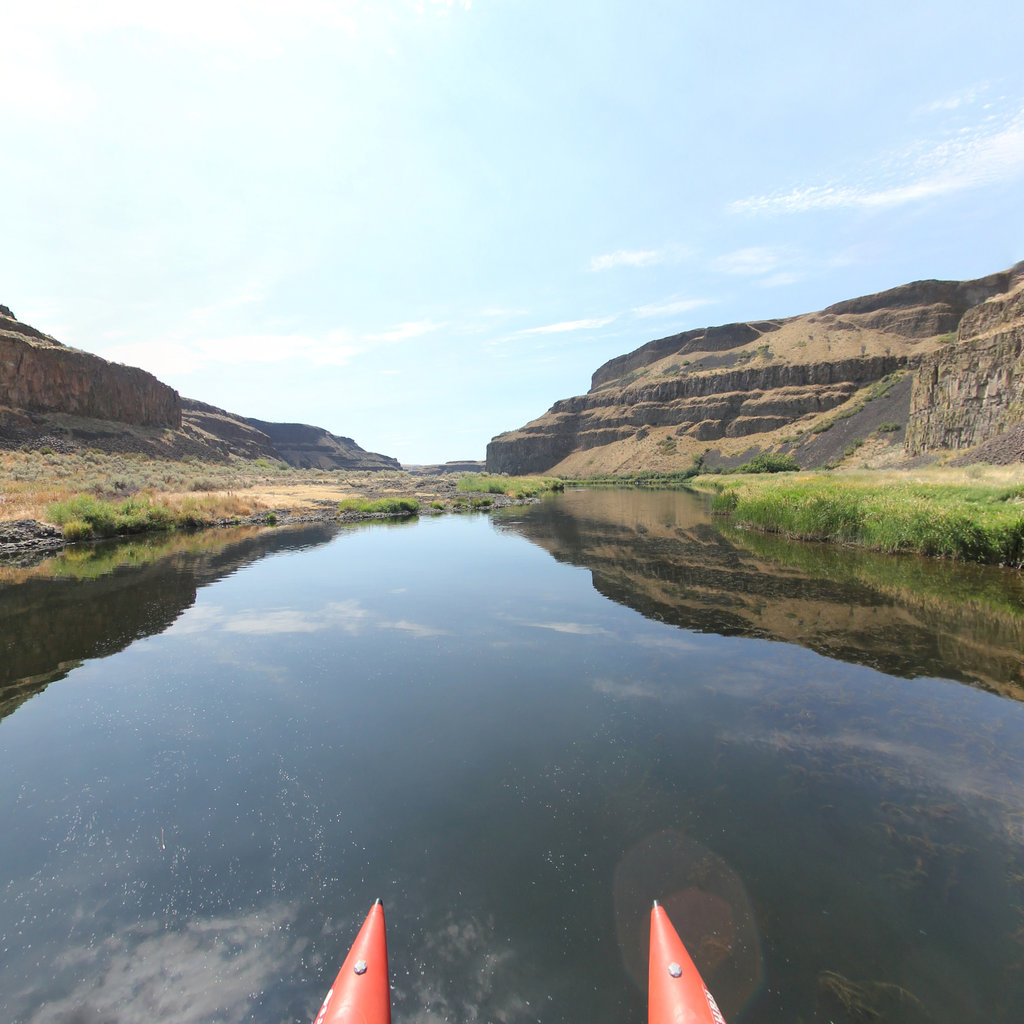
What's at stake, from the water: Palouse Falls to Lyons Ferry, Snake River WA.
Existing Terrain360 imagery from a nearby reach — a preview of the public-access value that buffer protection along the Mountain Home Air Force Base corridor would keep open.
The documentation layer
The record that backs the protection case.
Protecting the corridor is the goal; this is the documentation that supports it — baseline conditions and public-access value the partnership can reuse for REPI reporting, grant applications, and outreach.
Geo-referenced baseline dataset
Equirectangular panoramas + GPS tracks delivered to the installation INRMP team and the NPS Trail Office — documenting baseline conditions for REPI reporting, ESA Section 7, easement monitoring, and outreach.
Hosted 360° portal
Web-based interactive map showing pan-and-explore imagery of both riverbanks and every mapped trail. Mobile + desktop. Embeddable in any partner site.
Printable corridor maps
Asset index keyed to the imagery - suitable for visitor information, grant deliverable documentation, and partner co-branding.
L&C interpretive layer (optional)
Waypoint overlay tying the corridor to journal entries and historic sites - Tower Rock, Gates of the Mountains, the Falls portage, the Pacific arrival.
Asset inventory
What the corridor protects.
Each row is a recreation asset inside the buffer corridor — the public access and habitat a REPI/RARI easement would keep open.
| Recreation asset | Type | Miles | LCNHT | Access |
|---|---|---|---|---|
| Snake River — C.J. Strike Reservoir reach ~10 mi S | River | 30 | Near | Public |
| Snake River — Bruneau to Hagerman reach ~35 mi SE | River | 22 | Near | Public |
| Bruneau-Jarbidge Wild & Scenic River ~50 mi S | River | 18 | None | Public (BLM) |
| Snake River Birds of Prey NCA rim trails ~20 mi N | Trail | 25 | Near | Public (BLM) |
| Bruneau Dunes State Park trails ~20 mi S | Trail | 6 | None | Public |
| Owyhee Front (BLM) OHV routes ~40 mi S | Trail | 60 | None | Public (BLM) |
| Boise NF foothills trail network (Trinity Mtns) ~50 mi N | Trail | 30 | None | Public (USFS) |
| Cove Recreation Area / C.J. Strike launch ~10 mi S | Access | - | Near | Public |
| Bruneau Dunes State Park visitor center ~20 mi S | Access | - | None | Public |
| Swan Falls Dam Recreation Site ~25 mi N | Access | - | Near | Public (BLM) |
| Celebration Park (petroglyphs) ~30 mi NW | Access | - | None | Public |
Corridor map
Satellite view of the corridor footprint with the installation, its REPI buffer, and the recreation assets that protection keeps open.
The corridor up close